WMS Map Viewer ავტორი Pantelis Rodis
An application for viewing for web maps that use the WMS protocol
152 მომხმარებელი152 მომხმარებელი
გაფართოების მონაცემები
ეკრანის სურათები
გაფართოების შესახებ
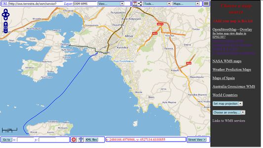
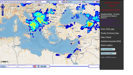
WMS Map Viewer is an advanced client for web mapping services that use the WMS protocol. That is interactive web maps from various sources. The application is compatible with all modern versions of web map protocols, ensuring an advanced and comfortable user experience. It is only necessary to input the URL of a WMS web service and the name of the layer that you wish to view and then you may view the map. The map layers that you open may be saved in HTML files for later use.
There are also built-in connections to popular and free WMS services of map and satellite data of OpenStreetMap, Spain, Australia and NASA.
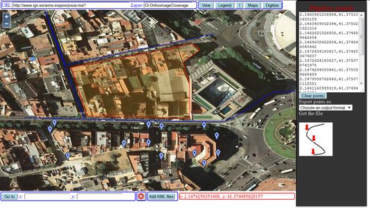
You may easily digitize points, lines or areas and export them as CSV or KML files.
There are also built-in connections to popular and free WMS services of map and satellite data of OpenStreetMap, Spain, Australia and NASA.
You may easily digitize points, lines or areas and export them as CSV or KML files.
5 შეფასება 5 მიმომხილველისგან
დამატებითი მონაცემები
- დამატების ბმულები
- ვერსია
- 1.5resigned1
- ზომა
- 218,08 კბ
- ბოლო განახლება
- 2 წლის წინ (25 აპრ 2024)
- მსგავსი კატეგორიები
- ლიცენზია
- Mozilla Public License 2.0
- პირადი მონაცემების დაცვის დებულება
- გაეცანით ამ დამატების პირადულობის დაცვის დებულებას
- სამომხმარებლო სალიცენზიო შეთანხმება
- გაეცანით სალიცენზიო შეთანხმებას, ამ დამატების შესახებ
- ვერსიის ისტორია
- კრებულში დამატება